USGS Quadrangles (QUADS)
The principal component of QUADS is a Google Earth network link that plots approximate USGS quadrangle boundaries (Fig. 1) and provides direct access to 132,101 geospatial PDF topo maps, including scans of the last historical paper map in all available grid sizes. All quadrangle balloons contain name, primary state, nominal grid size, scale, imprint year, and file size information with a link to the corresponding PDF map. See also USGS Maps and Topographic Map Symbols.
- Position the area of interest (AOI) in the viewer.
- Check the box beside the Search Results network link to display quadrangle placemarks and boundaries.
- On subsequent uses, reposition the AOI and ensure that the network link is checked and selected. When Refresh Mode is Automatic, search results are refreshed two seconds after camera movement stops. When Refresh Mode is Manual, choose Refresh from the Edit menu, or right-click and select Refresh in the context menu (explain).
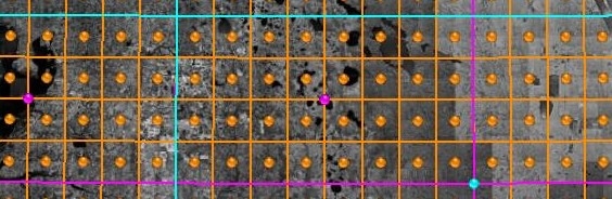
All quadrangle boundaries, balloon information, and linked content are supplied by the USGS. Data errors, accuracy, and availability are beyond the control of this application.
QUADS also includes overlays for topographic-bathymetric and hydrographic maps.
USGS Topographic Quadrangles
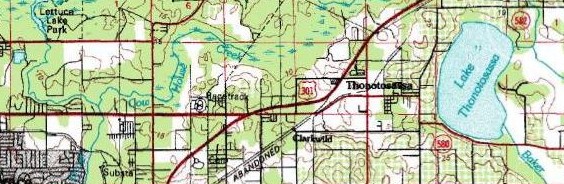
The TopoMaps network link retrieves multiresolution images of USGS topo maps (Fig. 2) from the Esri USA Topo Maps server. See also Topographic Map Symbols.- Position the area of interest (AOI) in the viewer.
- Check the radio button beside the TopoMaps network link.
- On subsequent uses, reposition the AOI and ensure that the network link is checked and selected. When Refresh Mode is Automatic, the overlay is refreshed two seconds after camera movement stops. When Refresh Mode is Manual, choose Refresh from the Edit menu, or right-click and select Refresh in the context menu (explain).
National Hydrography Dataset
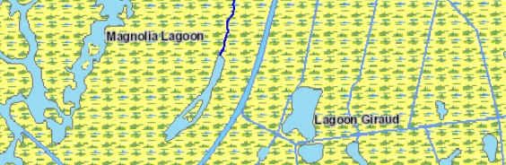
The Hydrography network link retrieves multiresolution images of the National Hydrography Dataset (NHD) (Fig. 3) from the EPA Office of Water (OW) NHDPlus v2.1. The service includes NHD point, line, and area features with labeled flowlines and waterbodies.- Position the area of interest (AOI) in the viewer.
- Check the radio button beside the Hydrography network link.
- On subsequent uses, reposition the AOI and ensure that the network link is checked and selected. When Refresh Mode is Automatic, the overlay is refreshed two seconds after camera movement stops. When Refresh Mode is Manual, choose Refresh from the Edit menu, or right-click and select Refresh in the context menu (explain).
All images are retrieved from remote servers. Data errors,
accuracy, and availability are beyond the control of this application.